Every Road Leads Where Someone Wanted It To: The Hidden Geography of Controlled Movement
The Maps They Didn't Show You
When President Eisenhower signed the Federal-Aid Highway Act in 1956, authorizing construction of the Interstate Highway System, the public justification focused on economic development, national defense, and improved transportation. The private conversations among planners revealed different priorities: the rapid movement of military personnel during emergencies, the circumvention of potentially hostile urban areas, and the strategic isolation of communities that might resist federal authority.
The Interstate system was sold as infrastructure for prosperity. It was designed as infrastructure for control.
This dual purpose—public benefit and strategic dominance—has characterized every major road-building project in recorded history. Rulers build roads to move armies, goods, and information efficiently, but they also build roads to determine where armies, goods, and information cannot go. The paths that get paved reveal who holds power. The paths that remain unpaved reveal who doesn't.
The Persian Express
The world's first highway system was built by the Achaemenid Empire around 500 BCE. The Royal Road stretched 1,600 miles from Sardis in modern Turkey to Susa in Iran, crossing mountains, rivers, and deserts that had previously isolated the empire's far-flung provinces.
Darius I, who commissioned the project, understood that controlling territory meant controlling movement. The Royal Road included way stations every fifteen miles, staffed with fresh horses and loyal personnel who could monitor traffic, collect intelligence, and relay messages across the empire faster than any previous communication system.
But the Royal Road didn't just connect Persian cities—it bypassed potential threats. The route avoided major population centers that owed allegiance to rival powers, skirted tribal territories that had resisted Persian expansion, and created alternative pathways that reduced Persian dependence on potentially hostile local leaders.
Cities that found themselves on the Royal Road prospered as centers of trade and administration. Cities that found themselves off the Royal Road discovered that prosperity required Persian cooperation. The road network became a tool for rewarding loyalty and punishing independence.
Greek historians marveled at the Royal Road's efficiency, but they also recognized its strategic purpose. Herodotus noted that Persian messengers could travel the entire length in seven days—faster than any army could march, but also faster than any rebellion could spread.
Roman Engineering, Roman Politics
Rome's road network expanded on Persian precedents while adding innovations that would influence transportation planning for the next two millennia. Roman engineers built roads that prioritized military movement over commercial convenience, strategic positioning over geographic efficiency.
The famous saying "all roads lead to Rome" obscures a more complex reality: Roman roads led where Roman legions needed to go, avoided areas where Roman authority was contested, and created transportation dependencies that reinforced political relationships.
Roman roads bypassed Celtic strongholds in Gaul, Berber settlements in North Africa, and Germanic tribal centers along the Rhine frontier. Instead, they connected Roman military bases, administrative centers, and loyal client cities, creating networks that facilitated Roman movement while limiting the mobility of potential enemies.
The Via Appia, Rome's most famous road, ran southeast from Rome toward the Greek cities of southern Italy—not because that was the most economically important direction, but because it was the most strategically vulnerable. The road enabled rapid legion deployment to suppress revolts, intercept invasions, and demonstrate Roman power to communities that might consider resistance.
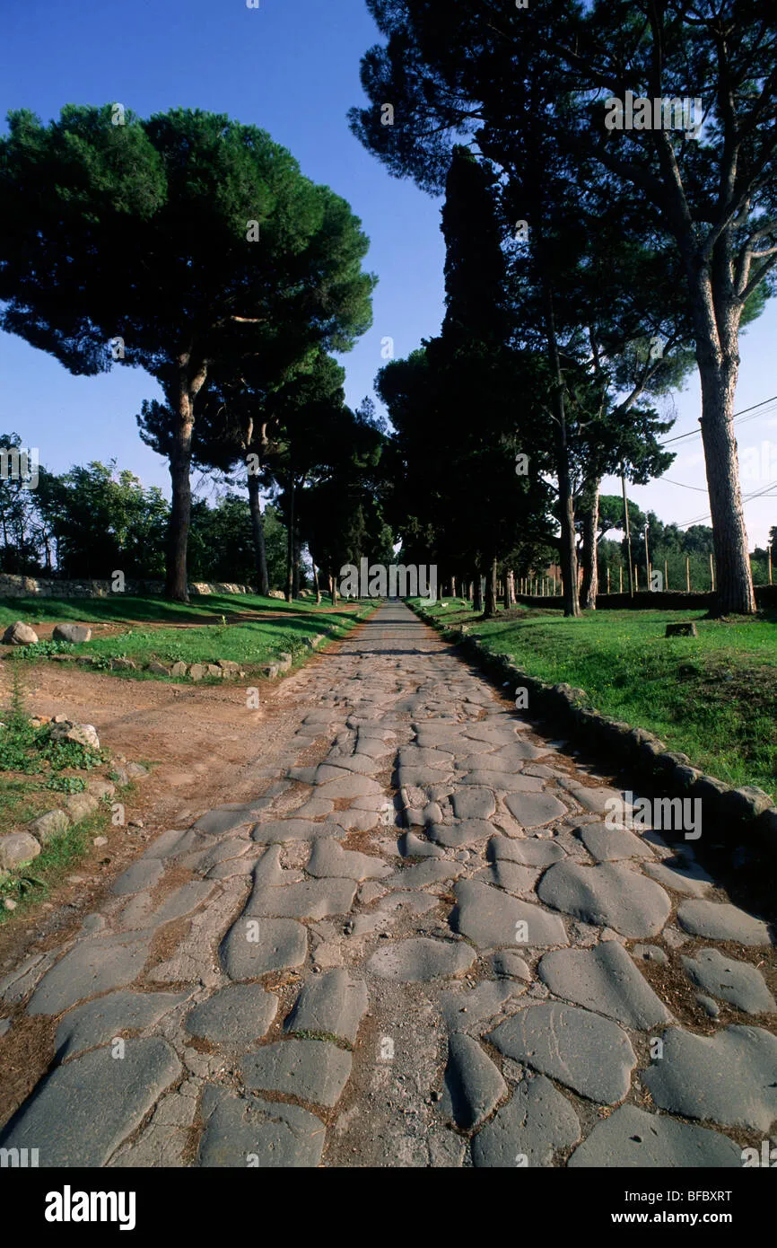 Photo: Via Appia, via c8.alamy.com
Roman road construction also served as economic warfare. Roads required massive labor inputs, typically provided by conquered populations working under Roman supervision. The construction process itself became a form of occupation, placing Roman engineers, administrators, and guards in previously autonomous territories for years at a time.
The Spanish Colonial Grid
Spanish colonial administrators inherited Roman road-building principles and adapted them to New World conditions. The camino real networks that connected Spanish settlements from California to Chile prioritized military communication and resource extraction over indigenous needs or natural geographic patterns.
Spanish roads connected missions, presidios, and administrative centers while systematically avoiding major indigenous population centers. This wasn't accidental—Spanish planners explicitly designed transportation networks to facilitate European movement while limiting indigenous mobility and communication.
The Camino Real de Tierra Adentro, which ran 1,600 miles from Mexico City to Santa Fe, passed through dozens of Spanish settlements but bypassed major Pueblo, Apache, and Comanche territories. Indigenous peoples could access Spanish roads, but only at Spanish-controlled crossing points where their movements could be monitored and regulated.
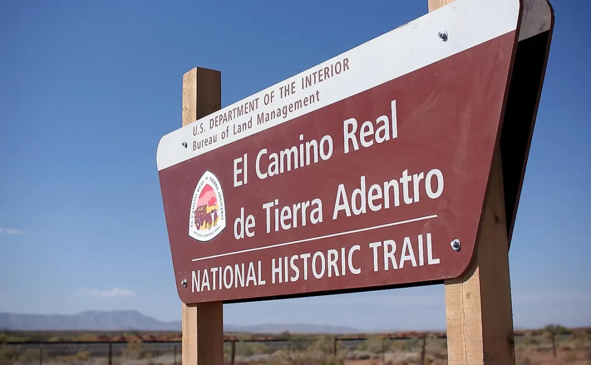 Photo: Camino Real de Tierra Adentro, via www.worldatlas.com
Spanish road networks also served as early warning systems. Standardized way stations, regular patrols, and mandatory travel documents created surveillance infrastructure that could detect unauthorized movement, monitor trade relationships, and gather intelligence on indigenous political activities.
When indigenous groups organized resistance movements, Spanish authorities often responded by cutting road access to rebellious territories, effectively imposing economic blockades that made sustained resistance difficult to maintain.
The Railroad Revolution
Nineteenth-century American railroad construction followed similar patterns of strategic inclusion and exclusion. Railroad companies, backed by federal land grants and military protection, built networks that served their economic interests while shaping political relationships across the expanding frontier.
Railroad routes determined which towns prospered and which towns died. Communities that secured railroad connections became regional commercial centers. Communities that were bypassed often disappeared within a generation, their populations migrating to railroad towns that offered better economic opportunities.
But railroad routing decisions weren't made purely on economic grounds. Railroad companies avoided territories controlled by hostile Indian tribes, bypassed areas with strong opposition to corporate development, and negotiated routes that maximized their political influence over local governments.
The transcontinental railroad, completed in 1869, was justified as a project to unite the continent and facilitate westward expansion. But military planners were explicit about the railroad's strategic value: it could move troops and supplies to the Pacific Coast faster than any previous transportation method, enabling rapid response to foreign threats or domestic rebellions.
Railroad construction also served as a form of territorial occupation. Railroad workers, engineers, and security personnel established semi-permanent camps in previously unsettled areas, creating American presence in territories that were still technically controlled by indigenous nations or foreign governments.
The Automotive Acceleration
The automobile era promised to democratize transportation, freeing individuals from dependence on railroad companies and government-controlled transit systems. But automobile infrastructure proved even more amenable to strategic manipulation than previous transportation networks.
Highway construction required massive public investment, giving government planners unprecedented control over transportation routing. Unlike railroads, which were built by private companies with their own agendas, highways were built by government agencies that could prioritize political and military objectives over economic efficiency.
Robert Moses, the most influential American transportation planner of the mid-twentieth century, was explicit about highways' social engineering potential. His parkway designs in New York included bridges too low for buses, effectively excluding public transportation and the working-class riders who depended on it from accessing certain beaches and recreational areas.
Moses understood that infrastructure design could enforce social segregation more effectively than legal segregation, because infrastructure discrimination looked like technical necessity rather than political choice.
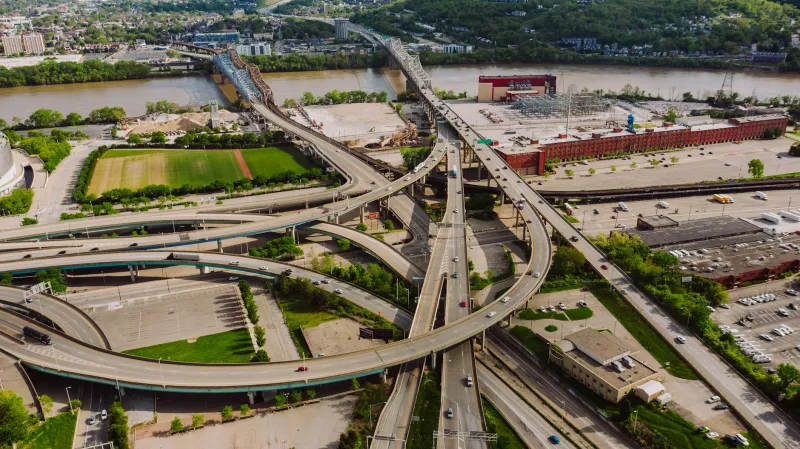
The Interstate Strategy
The Interstate Highway System represented the culmination of strategic transportation planning. Eisenhower, who had experienced German autobahn efficiency during World War II, wanted American highways that could move military equipment rapidly across the continent.
But Interstate planners went beyond military logistics. They designed routes that bypassed major urban centers, reducing the system's vulnerability to sabotage or civil unrest. They avoided areas with significant political opposition to federal authority. They created alternative pathways that reduced American dependence on potentially unreliable local transportation networks.
The Interstate system also served as urban planning policy. Highway routes through cities often targeted minority neighborhoods for demolition, destroying established communities while providing convenient transportation for suburban commuters. These routing decisions were presented as technical necessities, but internal documents reveal explicit racial and class considerations.
Interstate construction displaced over one million Americans, disproportionately affecting African American and immigrant communities that lacked political power to resist highway placement. The system that connected suburban America divided urban America, creating physical barriers that reinforced social segregation.
The Digital Highway
Contemporary internet infrastructure follows similar patterns of strategic inclusion and exclusion. Fiber optic cables, data centers, and cellular networks create digital transportation systems that determine which communities have access to economic opportunities and which communities remain isolated.
Broadband internet access correlates strongly with geographic proximity to major metropolitan areas, educational institutions, and government facilities—the same factors that influenced railroad and highway routing decisions in previous eras. Rural communities, Native American reservations, and low-income urban neighborhoods often lack reliable high-speed internet access, limiting their participation in digital economic activities.
Internet infrastructure also serves surveillance functions that echo ancient road networks' intelligence-gathering capabilities. Digital traffic flows through government-monitored chokepoints, enabling systematic observation of communication patterns, commercial relationships, and political associations.
The routing of internet traffic through specific geographic locations gives those locations—and the governments that control them—significant power over global information flows. Countries can monitor, filter, or block digital communications by controlling the physical infrastructure through which those communications travel.
The Eternal Bypass
Every transportation network creates winners and losers, insiders and outsiders, connected communities and isolated ones. The communities that get connected prosper. The communities that get bypassed struggle. The patterns repeat across every era because the underlying dynamics never change.
Rulers need to move resources, information, and personnel efficiently. They also need to control the movement of resources, information, and personnel by others. Transportation infrastructure serves both purposes simultaneously, creating systems that enable friendly movement while restricting hostile movement.
The roads that connect your community to economic opportunities also connect your community to external control. The highways that bring prosperity also bring surveillance. The networks that enable communication also enable monitoring.
Every road leads somewhere. Every road also leads away from somewhere else. The map of where the roads go reveals who built them and why. The map of where the roads don't go reveals everything else you need to know about power.